FIELDE ORBITAL OS · v4.2 CONSTELLATION SYNC · 183 SATS
FIELDE 00%

Initializing orbital & drone subsystems

[01] Synthesizing botanical PBR leaf & soil atlases···
[02] Growing 2,000+ wind-reactive canopy stalks···
[03] Calibrating FD-1 scout & hyperspectral gimbal···
[04] Lighting golden-hour atmosphere & telemetry···
[05] Compiling GPU shaders & locking flight path···
PRE-COMPILING PBR SHADERS & FIELD MESHES FOR 60 FPS FLIGHT SECURE LINK · AES-256
LIVE 3.2M hectares under AI watch right now

Detect disease
14 days before
it spreads.

Fielde fuses daily satellite imagery, autonomous drone scouts and plant-pathology AI to find disease, insects and nutrient stress at single-plant resolution — then tells you exactly where to treat, and where not to.

Free 50-ha pilot scan No hardware to buy Results in 48 hours

Stripe rust detected

12s ago

Plot 07 · Wheat · 96.4% confidence · 2.3 ha at risk

0%
Detection accuracy
0 days
Earlier than scouting
−0%
Pesticide use
0M ha
Monitored daily
Camera Auto director
SCROLL

Trusted by 4,800+ farms & cooperatives on 6 continents

GREENVALE FARMS AGRODYNE TERRA NOVA CO-OP SUNHARVEST GROUP NORTHPINE ESTATES AGRINOVA PRAIRIELINE FARMS VERDANTIA GOLDEN ACRE CO. BIOSPHERE AG
//01The Platform

Mission control for
every hectare you farm

One living map of your entire operation — refreshed daily from orbit, verified hourly by drones. Switch layers. Click an alert. This is a real Fielde workspace.

FIELDE OS · GREENVALE FARM · 412 HA SYNCED 06:12 UTC
A1 · Winter wheat · NDVI 0.84
LAT 52.4142°NLON 8.2317°ERES 0.5 CM/PX
StressedVigorous

Data layer

Multispectral vegetation index from today's satellite pass, verified by drone at leaf level.

//02How it works

From orbit to action in under six hours

Two eyes are better than one. Satellites never blink; drones never guess. Together they close the loop between detection and treatment.

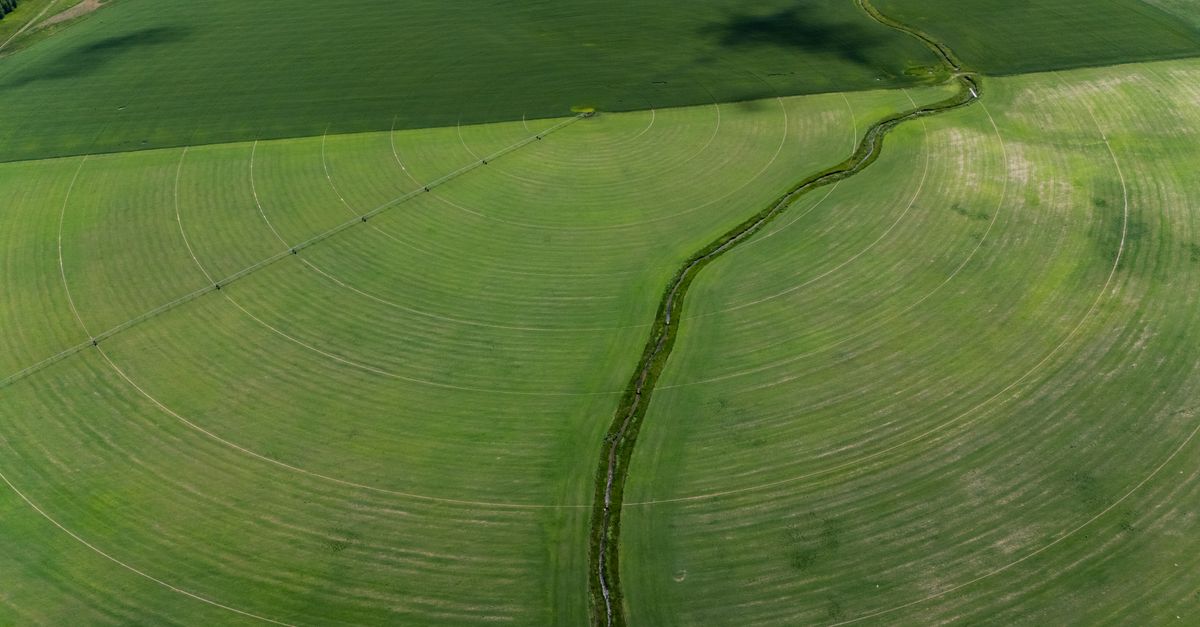
Circular irrigated fields seen from orbit STEP 01

Satellites sweep daily

Our constellation images every field on Earth, every day, in 12 spectral bands the eye can't see. AI compares each pixel against its own history and flags stress anomalies the moment physiology changes — days before colour does.

180+ satellites3 m resolutionDaily revisit
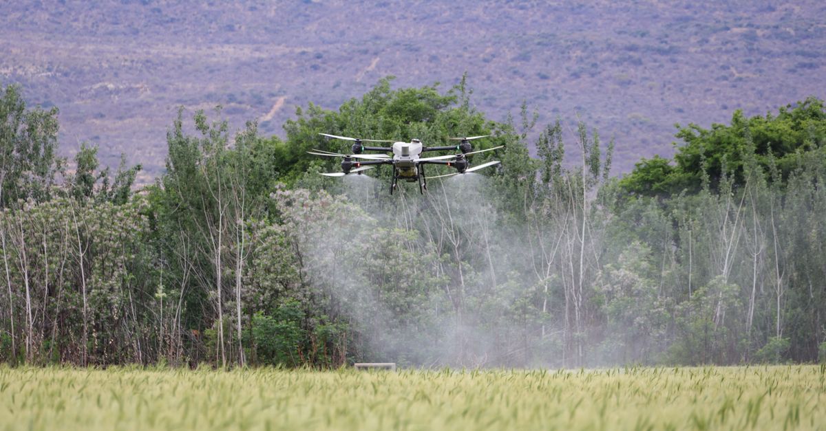
Autonomous drone flying over a green crop field STEP 02

Drones verify at leaf level

Flagged zones trigger an autonomous drone mission from a dock on your farm — no pilot needed. Multispectral cameras capture individual leaves at 0.5 cm per pixel, close enough to count aphids on a stem.

Fully autonomous0.5 cm / pixel60 ha per flight
Geometric crop rows forming a treatment map STEP 03

AI prescribes the fix

Models trained on 40M+ labelled plant images name the exact pathogen or pest, forecast its spread, and generate a variable-rate treatment map that loads straight into your sprayer. Treat 2 hectares — not 200.

340+ threats modelledSprayer-ready maps<6 h to your phone
180+Satellites in constellation
12Spectral bands per pixel
0.5 cmDrone ground resolution
40M+Labelled plant images
<6 hAnomaly → alert latency
Aerial RGB view of a farm
NDVI · FIELDE AI
StressedVigorous
RGB · HUMAN EYE
DRAG THE HANDLE · SAME FIELD, SAME MOMENT12 BANDS · 3 M ORBITAL · 0.5 CM DRONE
//03Spectral Vision

See what the
eye never could

Plants broadcast stress in wavelengths humans can't perceive. Fielde listens across the spectrum — then translates it into a map you can act on.

//04Capabilities

Everything that threatens yield, under watch

340+ pathogens modelled

Disease early-warning

Fungal, bacterial and viral infections change how a leaf reflects light long before lesions appear. Fielde reads that spectral fingerprint and alerts you while treatment is still cheap — and still works. Hover the chart.

Spectral anomaly — what Fielde sees Visible symptoms — what a scout sees After Fielde-guided treatment
Colony-level precision

Insect & pest tracking

Drone imaging counts colonies and feeding damage plant-by-plant, mapping infestation fronts so you spray the invasion — not the whole county.

−31% fertiliser spend

Nutrient deficiency mapping

Red-edge bands quantify nitrogen, potassium and micronutrient uptake per square metre, generating variable-rate fertiliser maps automatically.

−24% water use

Irrigation intelligence

Thermal canopy stress plus SAR soil-moisture radar spots blocked nozzles, leaks and dry pockets the day they happen — not at wilt.

Up to −77% herbicide

Weed detection

Species-level weed ID from drone passes, with spot-spray maps compatible with all major precision sprayers.

±4.1% forecast accuracy

Yield forecasting

Growth-stage tracking fused with hyperlocal weather predicts yield per plot from mid-season — plan storage, contracts and cashflow with confidence.

$0MCrop value protected / yr
0MAlerts acted on
+0%Average yield lift
0+Farms on Fielde
//05Detection Library

Trained on the threats
that actually cost you

Field-validated across 6 seasons with leading agricultural research institutes. Accuracy measured against laboratory-confirmed diagnoses.

+ 334 MORE THREATS IN THE FULL LIBRARY · NEW MODELS SHIP EVERY MONTH

//06Live Network

Right now, on
the Fielde network

A planetary nervous system for agriculture: satellites, drone docks and inference clusters working one continuous shift.

FLEET RADARTRACKING
SWEEP 4.0 S
RANGE 12 KM
SECTOR DE-BY-07
9 CONTACTS
fielde-ops — live event stream UTC
1,214Images / sec
1,284Drones airborne
8,412Alerts today
183/186Satellites online
//07Why farms switch

Boots, pixels, or both — verified

Scouting is honest but slow. Satellite-only tools are fast but blind to detail. Fielde closes the gap with a second, closer pair of eyes.

Manual scoutingstatus quo
Satellite-only toolsfirst generation
Fieldeorbit + drone + AI
Detection lead time
Day 0 — once visible
~5 days, if clear skies
Up to 14 days early
Ground resolution
Spot checks on foot
3–10 m pixels
0.5 cm per pixel
Coverage per day
≈ 40 ha per scout
Whole farm
Whole farm, drone-verified
Names the pathogen or pest
Agronomist visit + lab
Stress only, no diagnosis
340+ threats, 98% accuracy
Counts insects
Sticky traps, weekly
Not possible
Colony-level counts
Works under cloud
Yes
Blocked for days
SAR radar + drones fly under
Treatment maps
Blanket spray
Coarse zones
Sprayer-ready variable rate
Cost per hectare / year
$18 – 35 in labour
$3 – 6
From $4.90
//08Field Stories

Farmers who saw it
coming — and won

4.9 / 5 from 2,300+ verified farm reviews
Farmer standing in a lush green wheat field ≈ €212k of wheat saved

“Fielde flagged stripe rust in a corner of Plot 7 that looked perfectly healthy to me. We sprayed 3 hectares instead of 300. Our agronomist confirmed it in the lab two weeks later — by then we'd already saved the crop.”

Henrik WeissWeiss Grain Co. · 1,240 ha wheat · Bavaria, DE
Smiling farmer in a sunlit wheat field −44% insecticide spend

“The drone found armyworm at egg stage on the east 40. One targeted pass at dusk and it was done. Our insecticide bill dropped 44% in a single season, and the beneficial insects stayed.”

Tom BeckerBecker Family Farms · 860 ha corn & soy · Iowa, US
Senior grower smiling and holding a harvest of fresh vegetables +23% yield · −31% fertiliser

“Forty years of walking rows taught me to trust my eyes. Fielde taught me they're late. The thermal layer caught a failing pivot span three days before wilt — and the nitrogen map cut our fertiliser bill by a third.”

Marco BelliniBellini Orto & Vigna · 310 ha vegetables & vines · Emilia-Romagna, IT
//09ROI Calculator

What does 14 days of warning
do for your bottom line?

Your operation

640 ha
50 HA5005,000 HA
Primary crop
Plan

Model assumptions: regional average revenue per hectare, typical annual disease & pest loss by crop, and measured Fielde outcomes across 4,800 farms. Volume pricing applies above 2,000 ha.

Estimated annual impact

Net benefit / year
$0
Return multiple
0.0×
Yield protected from disease & pests+$0
Input savings (spray, fertiliser, water)+$0
Fielde Guardian subscription−$0

That's $0 per hectare — on a farm turning over $0. Most operations recoup the full annual subscription on their first avoided blanket spray.

Lock in this ROI — start free
//10Pricing

Pays for itself by the
first saved hectare

One untreated rust outbreak costs more than a decade of Fielde. Start with a free 50-hectare pilot — keep us only if we earn it.

Scout

Satellite eyes on every field

$4.90/ hectare
per year
  • Daily satellite monitoring (3 m)
  • Crop-health & moisture layers
  • Weekly anomaly digest
  • Yield forecast per plot
  • 3 team seats included
Start free pilot

Enterprise

For agribusiness & cooperatives

Custom
  • Dedicated drone fleet & on-farm docks
  • Custom crop & disease models
  • API, webhooks & data warehouse sync
  • Dedicated agronomist & 99.9% SLA
  • Multi-region portfolio analytics
Talk to sales

ALL PLANS INCLUDE A FREE 50-HA PILOT · NO HARDWARE PURCHASE · CANCEL ANYTIME

Questions from the field

No. Guardian and Enterprise plans include leased autonomous drones and a weatherproof dock installed on your farm. Missions launch, fly and upload automatically — Fielde maintains, insures and replaces the hardware.

Your free pilot delivers a full satellite health report within 48 hours of sharing field boundaries. Most farms act on their first money-saving alert — a skipped blanket spray or a caught irrigation fault — inside the first two weeks.

Fielde covers 40+ crops including cereals, maize, soybean, potato, canola, cotton, sugar beet, vineyards and orchards, across North & South America, Europe, Africa, Asia and Oceania. Satellites don't care about borders.

Treatment maps export in ISO-XML, Shapefile and direct integrations for John Deere Operations Center, Climate FieldView, Trimble, AGCO and most FMIS platforms. If your sprayer takes a prescription, Fielde can write it.

Patchwork farmland seen from high altitude

Your first field scan
is on us.

Tell us where to point the satellites. Within 48 hours you'll hold a full health report for 50 hectares — every stress zone, ranked by dollars at risk.

Free 50-ha pilot · No credit card · Results in 48 h